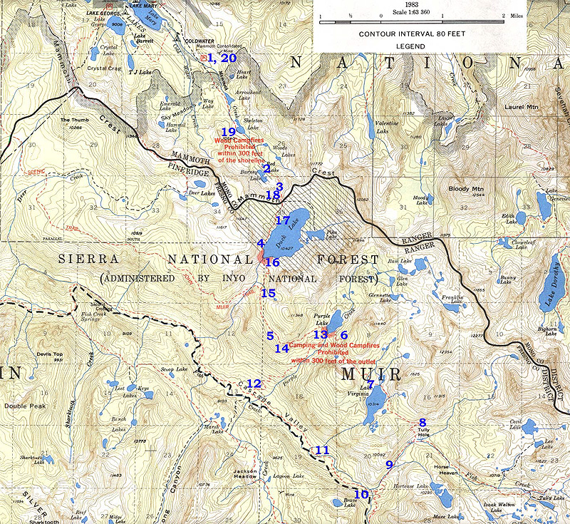
Through the magic of HTML and high-speed serial communications or broadband, you can
experience the beauty and serenity of a wilderness backpacking trip without
the normally associated pain and suffering. Below is a topographic map of BerrisBob's recent backpacking trip to the Mammoth Mountain area in the central
California Sierra Nevada mountains. Superimposed over the map are 20 blue
numerals, ranging from 1 to 20. These represent highlights or points of interest
on the trip in the order in which they were experienced. Placing the cursor
over one of the numbers and clicking will take you to another html document
which describes the event or location, often supplemented with photographs.
Though navigating through cyberspace in this fashion does not begin to compare
to actually making the trip yourself, it's the best we can do at this point.
So sit back, relax, and let your mouse-clicking finger do the walking. Your
feet will thank you.
NOTE: It has come to my attention that some of you have browsers that do not properly handle the image map below. If you click on one of the blue numbers in the topo map and nothing happens, then CLICK HERE for an alternative method.
If your browser doesn't work on the above map, then you can accomplish the same thing by clicking on the numbers below until you acquire a real browser.


![]()