We begin to descend the switchbacks from Lake Virginia into Tully Hole, now affectionately referred to as Tally Ho!. In the photo below, Barry and Phil can be seen on the trail at the right edge of the picture. In the middle left is Cascade Valley, the exit from Tully Hole. Tully Hole itself, which from our vantage point looks like a lush and beautifully manicured golf course, is out of the view to the lower left.
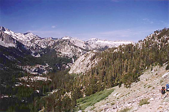
Across the canyon, is a nice jagged ridge of snow-lined mountains. Tully Hole lies buried in the heavily forested region in the center left of the photo below. At the left edge, a smaller, unnamed meadow (generally pronounced 'metal' by BerrisBob) is visible. Somewhere in that direction lies Tully Lake, which was originally part of the officially planned route, but it has been skipped because it turns out that it is farther away from the start than expected and time will not allow it.
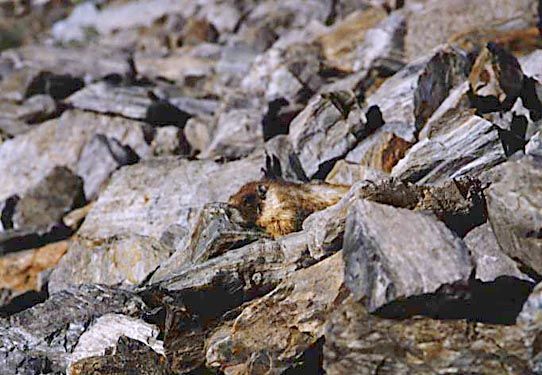
Wildlife has been curiously scarce on the trip so far, and had it not been for the acute eye of Phil, this marmot may have gone unnoticed as well. He was 'catching some rays' just 8 feet or so off the trail, and seemed completely indifferent to our presence. Someone spotted another marmot about 30 feet below the trail, and then several others began scurrying about. We suspect that they were up to either their typical whacky marmot hijinks or crazy marmot capers and started panicking when they realized that we spotted them- all except for this guy, who was either very boring or just way cool.
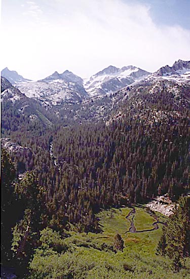
At last we get a view of Tally Ho!. In case you are wondering what all this Tully Hole stuff is about, it is just a meadow as can be seen in the accompaniing photo. Above and to the left you can see the upper regions of Fish Creek. I wanted to include a sound file in this web page that would demonstrate the roar made by the creek, but I don't know how yet. Sorry.